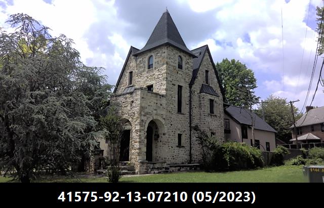
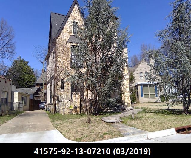
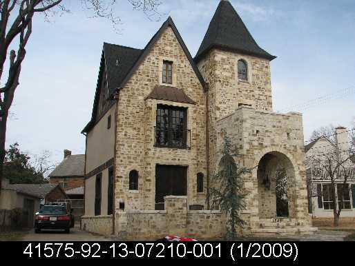
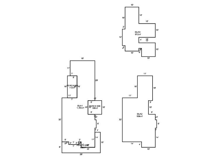
General Information
| Situs Address | 1241 E 27 PL S TULSA 741143917 |
|---|---|
| Owner Name |
NDB PROPERTIES SLLC
|
| Owner Mailing Address | 5422 PAINTER LN FORT SMITH , AR 729037126 |
| Account Type | Residential |
| Parcel ID | 41575-92-13-07210 |
| Land Area | 0.10 acres / 4,270 sq ft |
| School District | T-1A |
| Legal Description | Subdivision: SUNSET TERRACE (41575) Legal: LT 17 LESS BEG SELY COR TH ON CRV RT 21.7 NWLY67.1 NWLY48.9 SELY114.54 POB BLK 16 Section: 13 Township: 19 Range: 12 |
| Zoning | View City of Tulsa Zoning Data |
Improvements
Improvements
Tax Year: 2025
| Tax Year | Yr Blt | Property Type | Livable | Stories | Story Height | Baths | Roof |
|---|---|---|---|---|---|---|---|
| Imp # | Use | Foundation | Exterior | HVAC Type | |||
| 2025 | 1980 | Residential | 2,692 sqft | 2.50 | 8 | 2.10 | Composition Shingle |
| 1.00 | 2½ Story | Crawl Space | Frame Siding/Brick/Stone Veneer | Cool Air in Heat Ducts | |||
Tax Year: 2024
| Tax Year | Yr Blt | Property Type | Livable | Stories | Story Height | Baths | Roof |
|---|---|---|---|---|---|---|---|
| Imp # | Use | Foundation | Exterior | HVAC Type | |||
| 2024 | 1980 | Residential | 2,692 sqft | 2.50 | 8 | 2.10 | Composition Shingle |
| 1.00 | 2½ Story | Crawl Space | Frame Siding/Brick/Stone Veneer | Cool Air in Heat Ducts | |||
Tax Year: 2023
| Tax Year | Yr Blt | Property Type | Livable | Stories | Story Height | Baths | Roof |
|---|---|---|---|---|---|---|---|
| Imp # | Use | Foundation | Exterior | HVAC Type | |||
| 2023 | 1980 | Residential | 2,692 sqft | 2.50 | 8 | 2.10 | Composition Shingle |
| 1.00 | 2½ Story | Crawl Space | Frame Siding/Brick/Stone Veneer | Cool Air in Heat Ducts | |||
Values and Tax Information
| 2023 | 2024 | 2025 | |
|---|---|---|---|
| Fair Cash(Market) Value | $459,329 | $527,688 | $607,000 |
| Total Taxable Value (Capped) | $409,375 | $429,844 | $607,000 |
| Improvement Value | $391,489 | $459,848 | $539,160 |
| Land Value | $67,840 | $67,840 | $67,840 |
| Assessment Ratio | 11% | 11% | 11% |
| Gross Assessed Value | $45,031 | $47,283 | $66,770 |
| Exemptions | $0 | $0 | $0 |
| Net Assessed Value | $45,031 | $47,283 | $66,770 |
| School District | T-1A | ||
| Tax Rate | 126.91 | 129.51 | 129.51 |
| Estimated taxes | $5,715 | $6,124 | $8,647 |
| Last Notice Date | 1/28/2025 | ||
Exemptions Claimed
| 2023 | 2024 | 2025 | |
|---|---|---|---|
| Homestead | - | - | Apply |
| Additional Homestead | - | - | - |
| Senior Valuation Limitation | - | - | - |
| 100% Disabled Veteran | - | - | - |
Sales/Documents
| Sale Date | Grantor | Grantee | Sale Price | Deed Type | Document Number |
|---|---|---|---|---|---|
| 4/20/2024 | TETER, MICHAEL II & GOLNAZ BASSIRI | NDB PROPERTIES SLLC | $518,000 | Warranty Deed | 2024035292 |
| 2/1/2016 | ARGABRIGHT, JOHN JR & CHRISTA | TETER, MICHAEL II & GOLNAZ BASSIRI | $350,000 | Warranty Deed | 2016010864 |
| 9/16/2010 | HEATON, JULIE S | ARGABRIGHT, JOHN JR & CHRISTA | $300,000 | Warranty Deed | 2010085705 |
| 1/4/2010 | BANKS, CRAIG A | HEATON, JULIE S | $0 | Quit Claim Deed | 2010004441 |
| 8/1/2005 | ALFIERI, MICHAEL | BANKS, JULIE S | $222,000 | General Warranty Deed | 2005108556 |
| 8/1/2001 | $170,000 | History | 2000109763 BK-06576PG-00898 | ||
| 11/1/1991 | $125,000 | History | 2000109764 BK-05362PG-01251 |
Sales/Documents
| Sale Date | 4/20/2024 |
|---|---|
| Grantor | TETER, MICHAEL II & GOLNAZ BASSIRI |
| Grantee | NDB PROPERTIES SLLC |
| Sale Price | $518,000 |
| Deed Type | Warranty Deed |
| Document Number | 2024035292 |
| Sale Date | 2/1/2016 |
| Grantor | ARGABRIGHT, JOHN JR & CHRISTA |
| Grantee | TETER, MICHAEL II & GOLNAZ BASSIRI |
| Sale Price | $350,000 |
| Deed Type | Warranty Deed |
| Document Number | 2016010864 |
| Sale Date | 9/16/2010 |
| Grantor | HEATON, JULIE S |
| Grantee | ARGABRIGHT, JOHN JR & CHRISTA |
| Sale Price | $300,000 |
| Deed Type | Warranty Deed |
| Document Number | 2010085705 |
| Sale Date | 1/4/2010 |
| Grantor | BANKS, CRAIG A |
| Grantee | HEATON, JULIE S |
| Sale Price | $0 |
| Deed Type | Quit Claim Deed |
| Document Number | 2010004441 |
| Sale Date | 8/1/2005 |
| Grantor | ALFIERI, MICHAEL |
| Grantee | BANKS, JULIE S |
| Sale Price | $222,000 |
| Deed Type | General Warranty Deed |
| Document Number | 2005108556 |
| Sale Date | 8/1/2001 |
| Grantor | |
| Grantee | |
| Sale Price | $170,000 |
| Deed Type | History |
| Document Number | 2000109763 BK-06576PG-00898 |
| Sale Date | 11/1/1991 |
| Grantor | |
| Grantee | |
| Sale Price | $125,000 |
| Deed Type | History |
| Document Number | 2000109764 BK-05362PG-01251 |


